 |
 Sunday, April 4, 2010 @ 5:05 AM
After visiting the Urban Redevelopment Authority of Singapore, i found out that the urban planning of Singapore are not accidental but rather, they are intensively being reviewed to see whether its feasible in the years to come. Take the Concept Plan for example, they plan it for a period of like more than 10 years. However, at every 5 years interval, they would review the plan again to improve on the plan so that it really implies to the current situation in Singapore to keep it updated. Certainly, much effort has been put in to contribute to what Singapore has become now and these attributes to those Urban Planners effort to make full use of Singapore's limited amount of land. In my opinion, these Urban Planners are very far-sightly as they have already seen the shortage of land even 30 years ago and reclaimed the piece of land in Marina Bay. Even though that piece of land has not been used for over 30 years, however it has now becomed an important piece of land to expand the financial district from Shenton Way to Marina. As more and more developments are on their way, URA is also constantly trying to develop Singapore into a City in the Garden to reduce the use of resources as being a Garden city does help to cool down buildings and thus reducing the amount of electricity needed to cool down a building. Therefore, i feel that URA should be appreciated for the contributions that they have done to Urban Planning in Singapore and i definitely look forward to see the even more intensive planning that they planners have done for the Urban Planning in Shanghai! Jun Wen @ 4:57 AM
After going to URA, I then realised how singapore's limited land area is so extensively planned by the urban planners there and they look into the future 30 to 40 years in advance as to what areas in which how the land will be used. I feel that in Singapore's journey to success, URA has done alot in making things on the drawing board reality and they are the un-sung heros which hardly a few people know of them and those huge efforts they have put in. Beng Koon. @ 4:55 AM
URA visit on 29th march 2010 “Meet the planner” session In our URA visit, we had our questions answered and our understanding on the Singapore urban planning deepened. Before the URA visit, we were advised to come up with numerous questions that we felt we had to clarify in order to understand the complex urban planning of Singapore. These are some of the questions we had and the answers we got from the URA. -How does reclaimed land affect the number and height of the buildings that are built on it? From what we have found out, we believe that reclaimed land does not seem to have any effects that could affect the number and height of the buildings that are situated on it. However, there are suggestions to enforce stricter building requirements for sky scrapers that built on reclaimed land and strengthening of the reclaimed soil as it will be a potential danger if there is an earthquake. Almost twenty percent of Singapore’s surface area is reclaimed land. Scores of buildings that include houses, factories and hotels are located there. In the event of an earthquake, buildings will be shaken up more violently as compared to those on non-reclaimed land, which is solid and will not be liquefied by the shake. -What are the height restrictions for buildings that are built near the airport? Height restriction laws are always applied for the surroundings of airports, because too tall structures of any kind are always a danger for flight safety. Often red and white paint and flight safety lamps have to be installed on high structures (taller than 100m) far away from airports. Zhou Bo Monday, March 1, 2010 @ 12:09 AM
Climate in Shanghai Shanghai has a humid subtropical climate (Koppen climate classification) and experiences four distinct seasons. In winter, cold northerly winds from Siberia can cause nighttime temperatures to drop below freezing. Summer in Shanghai is very warm and humid, with occasional downpours or freak thunderstorms. The most pleasant seasons are Spring, although changeable, and Autumn, which is generally sunny and dry. Shanghai experiences on average 1,878 hours of sunshine per year, with the hottest temperature ever recorded at 40 °C (104 °F), and the lowest at −12 °C (10.4 °F). The average number of rainy days is 112 per year, with the wettest month being June. The average frost-free period is 276 days.   Climate of Singapore Under the Köppen climate classification system, Singapore has a tropical rainforest climate with no distinctive seasons. Its climate is characterized by uniform temperature and pressure, high humidity, and abundant rainfall. Temperatures range from 22 °C to 34 °C (72° to 93 °F). On average, the relative humidity is around 90% in the morning and 60% in the afternoon. The lowest and highest temperatures recorded in its maritime history are 19.4 °C (66.9 °F) and 35.8 °C (96.4 °F) respectively. May and June are the hottest months, while November and December make up the wetter monsoon season. From August to October, there is often haze, sometimes severe enough to prompt public health warnings, due to bush fires in neighbouring Indonesia. Singapore does not observe daylight saving time or a summer time zone change. The length of the day is nearly constant year round due to the country's location near the equator. .jpg)
Importance of Shanghai Geographically Similarly, Singapore's importance geographically… On 29 January 1819, Sir Thomas Stamford Raffles landed on the main island. Spotting its potential as a strategic trading post for Southeast Asia, Raffles signed a treaty with Sultan Hussein Shah on behalf of the British East India Company on 6 February 1819 to develop the southern part of Singapore as a British trading post and settlement. Thats all for Shanghai's climate and Geographical similarity with Singapore. Jun Wen! @ 12:04 AM
The geography of Shanghai is characterised by its location on the Yangtze River Delta on China's east coast and its proximity to the Pacific Ocean via the East China Sea. The city is centred around the Huangpu River, a tributary of the Yangtze River, and extends outwards in all directions, with the suburbs and satellite towns reaching east to the East China Sea, north and west to Jiangsu province, and south to Zhejiang province over Hangzhou Bay. The vast majority of Shanghai's land area is flat, apart from a few hills in the southwest corner, due to its location on the alluvial plain of the Yangtze's river delta. The city has many rivers and lakes and is known for its rich water resources, and thanks to its coastal, riverside location and warm climate ensuring ice-free waters, provides easy access to China's interior, resulting in Shanghai being the world's largest port. Location : Yangtze River Delta Coordinates : 31°12′N 121°30′E / 31.2°N 121.5°E Area : Total: 6,340 km2 (2,447.9 sq mi) - Land: 6,218 km2 (2,400.8 sq mi) - Water: 121 km2 (46.7 sq mi) Average Elevation : 4 m (13 ft) above sea level Waterways Shanghai contains 53.1 km (33.0 mi) of rivers and streams and is part of the Lake Taihu drainage area. Suzhou Creek is 125 km (78 mi) long and has an average width of 70 to 80 meters, while the Huangpu River is 80 km (50 mi) long and is around 400 meters wide IslandThere are three larger low-altitude alluvial islands in the mouth of Yangtze. Chongming Islang in the middle of the Yangtze is an alluvial island formed by silt carried along the river. It gives the name to the Chongming County , the only county of Shanghai. It is the third largest island in China at 1,041.21 km2 (402.01 sq mi). The other two are ChnagxingIsland at 88.54 km2 (34.19 sq mi), and Hengsha Island at 55.74 km2 (21.52 sq mi). Shanghai has also number of smaller islands under its jurisdiction. The Jiuduansha Island has the national nature reserve,Jiuduansha Wetland Dajinshan Island ,Xiaojinshan Island , and Fushan Island in Jinshan District . are nature reserves under city jurisdiction. Some alluvial islands are relatively young. For example, Jiuduansha emerged in 1950s. In 2006, the city had 19 uninhabited islands covering 226.27 square kilometers, with a total coastline length of 309 kilometers. Dajinshan has the highest point of Shanghai with altitude of 103.4 m. Bengkoon here :DSunday, February 28, 2010 @ 11:50 PM
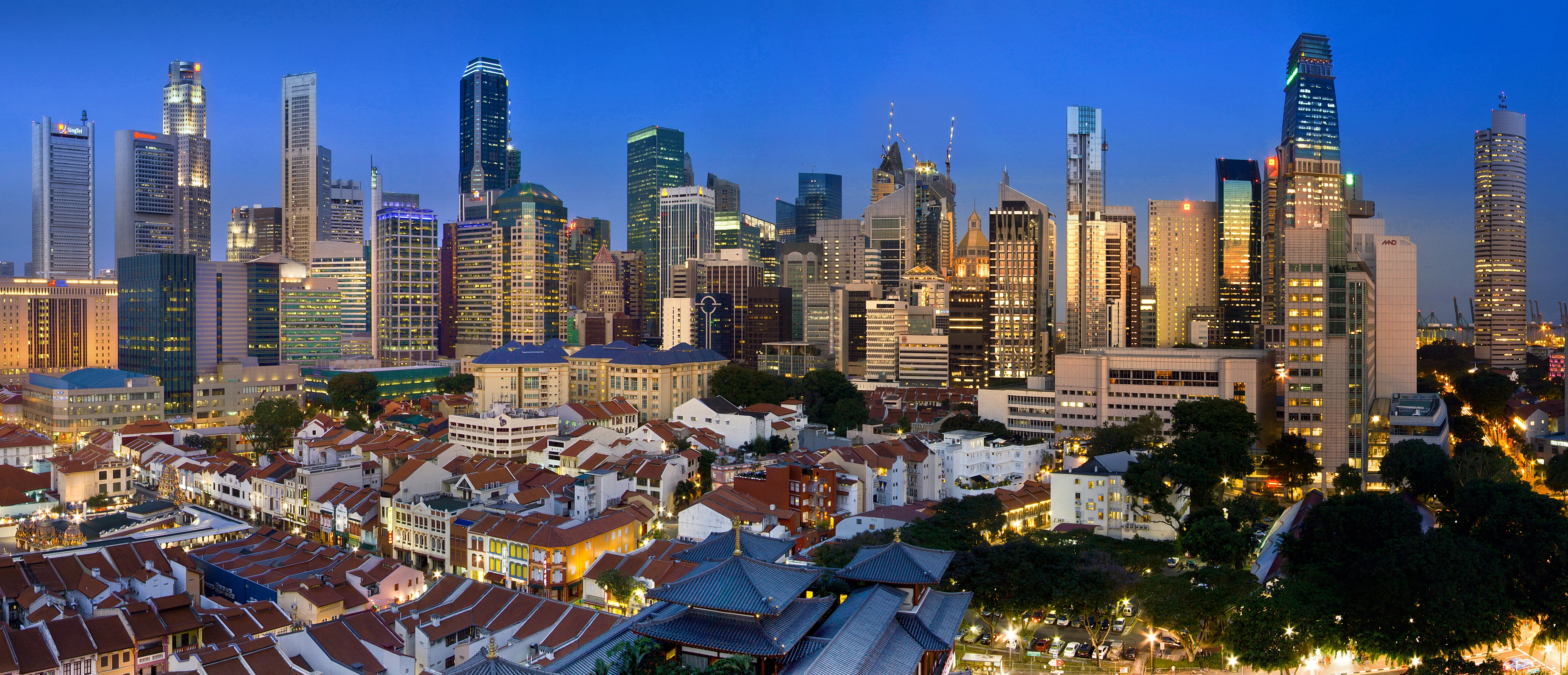
Shawn is like pissing me off now he trying to walk around with a green band around his legs and i'm daring him to shut up a bit of peace and calm without his irritating noise Ok back to topic We're doing on Shanghai's geography and there are two links here to show some places of attraction and the condition of Shangahi One is actually showing the nice side of it And the other showing how polluted it is The cities with the most beautiful skylines in the world rated by National Geography are as follows: 1. Hong Kong, China 2. Chicago, USA 3. Shanghai, China 4. New York City, USA 5. Tokyo, Japan 6. Singapore 7. Toronto, Canada 8. Kuala Lumpur, Malaysia 9. Shenzhen, China 10. Seoul, South Korea Beng Koon :D |
 |
 Hello peeps! We are the Stars people. This is our Star Blog and Group Members includes: Oen Beng Koon, Gina Phua, Zhou Bo, Tan Sok Hian, Loo Jun Wen. This blog contains our weekly updates on the Geography of Shanghai and Singapore!! bold italic underline |
 |
 Hey, Feel free to Comment before you leave!! |
 |

 February 2010
March 2010 April 2010  designer designer (blog) code (navigations) code (menus) pattern font brushes software |